How much nature is Europe losing to construction? A cross-border investigation set out to find the answer — and the scale surprised even the researchers.
Europe is building at a relentless pace. Logistics hubs rise on former farmland. Wind turbines pierce mountain ridgelines. Industrial zones replace wetlands. What was once green is turning grey.
The cross-border investigation Green to Gray, coordinated by Arena for Journalism in Europe, and now shortlisted for this year’s Sigma Awards, set out to answer a deceptively simple question: How much nature is Europe losing to construction?
The answer required satellite imagery, artificial intelligence, field reporting in multiple countries and remote regions, and months of verification and negotiation between journalists and scientists over what counts as proof.
Eleven newsrooms, one mission
The seed of the investigation was planted in Norway.
A team at Norwegian Broadcasting Corporation (NRK) had worked with scientists from the Norwegian Institute for Nature Research (NINA) to map nature loss in Norway using satellite imagery. When Zeynep Şentek, project coordinator of Green to Gray, project director of the Arena Climate Network, a journalist and board member of the independent non-profit platform The Black Sea, saw it, she immediately imagined something bigger.
“I get very excited about investigations,” she says. “I wasn’t sure if practically it would be possible to scale it up to other countries — if the methodology would work elsewhere — but I just became super excited about the project,” she admitted.
To explore that possibility, the Arena team invited NRK and NINA to a meeting at the 2024 Climate Arena conference, bringing together other national media organizations to examine the methodology and discuss how it could be adapted beyond Norway. The conversation marked the first concrete step toward a broader collaboration.
Scaling it to Europe meant convincing newsrooms, securing funding, and — crucially — persuading scientists to adapt their model.
“In many ways they didn’t have to do it,” Şentek explains. “To scale something to Europe is extra work. They would have to share their lessons learned and refine the methodology. But they were very open and very excited.”
Eleven media partners joined — a mix of major outlets and smaller investigative teams. Among them was Reporters United, a network supporting investigative journalism in Greece, and The Black Sea.
“It cannot just be big media,” Şentek notes. “That’s unfair. Smaller teams can do really amazing work but often don’t have access to this kind of cross-border collaboration. So we tried to strike that balance,” she added.
In total, the following newsrooms participated in the study: Datadista (Spain), De Standaard (Belgium), Die Zeit (Germany), Facta (Italy), Gazeta Wyborcza (Poland), Le Monde (France), Long Play (Finland), NRK (Norway), Reporters United (Greece), The Black Sea (Turkey), and The Guardian (UK).
When journalists and scientists speak different languages
At the heart of the investigation was what Şentek calls a “very data-heavy project”: detecting land take — the expansion of built-up areas into nature and agricultural land — using satellite imagery and AI.
Zander Venter, a scientific collaborator at NINA, had originally developed the methodology for Norway. Now he had to adapt it to the entire European continent.
“My role was generating the map using satellite imagery and the algorithms we developed in Norway, and tailoring them to the European scale,” he explains.
Europe’s ecological diversity posed a significant challenge.
“At the European scale, there’s a lot of climatic and biological variation from North to South and East to West,” Venter says. “We had to adapt the algorithm to map land take accurately across very different regions,” he clarifies.
Satellite image time series were processed through AI models to detect changes, but raw classifications were not enough.
“I also guided the journalists through a verification process,” Venter explains. “It was necessary to have statistically robust area estimates — to be able to say how much land was lost per country — and to quantify the accuracy of the map and correct errors,” he remarked.
This is where productive tension emerged.
“For scientists, uncertainty is part of innovation,” Şentek highlights. “If there are margins of error, that’s normal. But for journalists, the methodology has to be rock solid. We need to say clearly: this much land has been lost,” she mentioned.
The team went back and forth, refining calculations and double-checking outputs. The verification process involved cross-checking AI outputs with human interpretation. Then something unexpected happened.
“At the end it gave us really strange results,” Şentek recalls. “After double-checking, we realized that actually in many cases the AI was right and humans were wrong. We had wrongly verified it. That was a moment where we thought — maybe sometimes we need to trust AI a bit more,” she pointed out.
The final dataset gave each newsroom comparable, statistically defensible national figures, and the ability to connect them to local realities.
Explore a simplified four-step guide designed for those interested, even without a background in data. Find full methodology here


A continent under construction
The findings were striking. Across Europe, natural and agricultural land equivalent to thousands of football fields every year is being converted into built-up areas. The annual rate of land take is 1.5 times higher than the official estimates reported by the European Environment Agency (EEA). Between 2018 and 2023 alone, the total land take amounted to an area comparable to the size of Cyprus.
Forests vanish in Scandinavia, coasts shrink in the south, and farmland disappears in Central Europe. Turkey, Poland, France, and Germany top the list in sheer loss, while small countries like the Netherlands and Belgium lose the most relative to their size. In Greece, roughly 30% of previously “untouched” mountain areas are affected by renewable energy projects holding production licenses.
The main drivers extend well beyond housing demand. Industrial expansion, logistics hubs tied to global e-commerce, large-scale infrastructure projects, tourism complexes, renewable energy installations and manufacturing zones account for much of the growth.
Across countries, the pattern was clear: Europe is building relentlessly — often in ecologically sensitive areas, often before spatial planning and protection frameworks are updated.
As Şentek puts it:
The problem is that we build non-stop — huge logistics centers, giant factories, luxury housing, luxury tourism. It’s consumerism that cannot be contained. And it needs construction.
Turkey: Putting a number on a known reality
Turkey quickly stood out in the data.
When early calculations showed Turkey at the top of the land-conversion ranking, Şentek knew a Turkish newsroom had to be involved. “There was going to be something big there,” she says. The Black Sea newsroom took on the story. What they uncovered confirmed what many citizens already suspected, but had never seen quantified.
“It wasn’t surprising that there is a construction craze,” Şentek explains. “But we didn’t know the scale. When you can put a number on how much land was lost in five years — it becomes real.”
From 2018 to 2023, approximately 2 million acres (1,860 km²) of natural land and farmland were lost—an area larger than Greater London.
According to Şentek, the drivers were multiple: massive industrial manufacturing zones were among the primary forces, alongside government-backed infrastructure “mega projects,” airports and logistics hubs, coastal tourism complexes, and expansion into agricultural and wetland areas.
“It’s very political,” she underlines. “What do you sacrifice to build what? That tells you where the priorities lie.”
It’s very political. What do you sacrifice to build what? That tells you where the priorities lie.
Zeynep Şentek, Project Coordinator of Green to Gray
In some cases, forests were cleared for airports. In others, farmland was converted into industrial zones producing car parts for export. Farmers described losing land to state-backed development.
“They just took my land,” one farmer told reporters. He sued, “but you sue the government; you know you’re not going to win,” she remarks.
The findings resonated so strongly that they reached the Turkish parliament, sparking calls for further scrutiny.
“People don’t know how much of it is gone for unnecessary things,” Şentek notes. “When you show them satellite images — before and after — and say this is just one project, and there are hundreds more, it’s incredibly powerful.”
Greece: Energy transition and the mountains that were once untouched
In Greece, Reporters United focused on roadless mountain areas. As journalist Dafni Karavola explains, the Europe-wide dataset served mainly as a starting point: “The algorithm was developed in Norway. Greece, however, has a completely different terrain and climate. So, we mainly used the dataset as a qualitative guide.”
The team combined the European data with information on ecologically valuable zones mapped by biodiversity researchers at the University of Ioannina, as well as data from the Hellenic Regulatory Authority for Waste, Energy and Water (RAAEY) on wind turbine permits.
The outcome was stark.
“Nearly one in three untouched mountains — roughly 30% — is threatened by projects with production licenses,” Karavola shares.
Field reporting in the Vermio mountain range — a former lignite-burning area transitioning to renewables — revealed a complicated reality.
The roadless area (RA) of Hamitis, the highest peak of Mount Vermio


In 2021 and 2025—before and after the construction of the Gkiona–Bourika wind farm by the company Aioliki Vermiou S.A., owned by Aer Soleir (interests of Quantum Capital Group), under a fifteen-year energy supply agreement with Amazon, according to the investigation by Reporters United. The blue boundaries indicate the limits of the roadless area. Data sources: Biodiversity Conservation Lab (June 2022), ΡΑΑΕΥ (May 2025), Copernicus Browser. Courtesy of: Reporters United.
Reporters United visited Vermio and Askio in Macedonia for two reasons: satellite analysis identified Vermio as the most heavily affected area, while Amazon’s involvement there — as a global corporate player — raised broader questions about scale and corporate responsibility.
According to the investigation, a large wind-power project under construction in this area includes a cluster of 59 turbines and nearly 291 MW of capacity and is expected to be completed this spring. Behind that project stands Amazon, which announced in November 2024 that it would invest $1 billion in wind farms in Vermio and in the Peloponnese, committing to purchase the electricity they produce for 15 years. The investigation notes that parts of this wind project are located within officially mapped roadless areas, zones scientists consider some of the closest examples of true wilderness in Greece.
“Yes, there is a shift away from fossil fuels,” Karavola reflects. “But with what terms and at what cost? Is there a way to achieve the green transition without destroying pristine natural areas?”
On-site investigation revealed elements invisible from satellite data:
“When you go there, you see things you cannot measure remotely — tree trunks cut and left aside; new roads opened inside roadless areas. The destruction was much larger than we could calculate from afar,” she remarks.
Local grassroots movements played an essential role in facilitating access, guiding reporters through the mountain terrain. By contrast, as reported in the investigation, Aer Soléir, the company holding the project declined to provide a site visit, telling journalists to return once the project had been completed.
The reporting revealed a policy paradox: renewable energy expansion proceeding faster than updated spatial planning and environmental zoning. It also showed that, beyond Amazon’s involvement, other major energy companies — including Public Power Corporation (Greece), Iberdrola (Spain), EDF (France), EDP (Portugal) — have built or are building wind farms in previously undisturbed wilderness areas, covering a total of 1,487 acres of roadless land and creating 60 km of new roads.

Satellite image source: Google Earth 2025, Maxar Technologies.
Courtesy of: Reporters United.

Satellite image source: Google Earth 2025, Airbus.
Courtesy of: Reporters United.
“The numbers were shocking,” Karavola highlights. “But what was even more important was realizing this is not an isolated case. Europe is losing natural land every single day.
The investigation “Green to Gray” stood out among 543 entries from 84 countries and is one of the 31 projects shortlisted for the 2026 Sigma Awards, the international prizes that recognize the best in data journalism. Veteran jurist Kuek Ser Kuang Keng noted that “this year’s projects exceed expectations in both quality and innovation”—and “Green to Gray” is among those making a difference. The winners will be announced in spring 2026.
The Nature Loss App: Science meets citizens and vice versa
Beyond Europe, the project is expanding globally through NINA’s crowdsourcing initiative: the Nature Loss Detector app.
Venter explains:
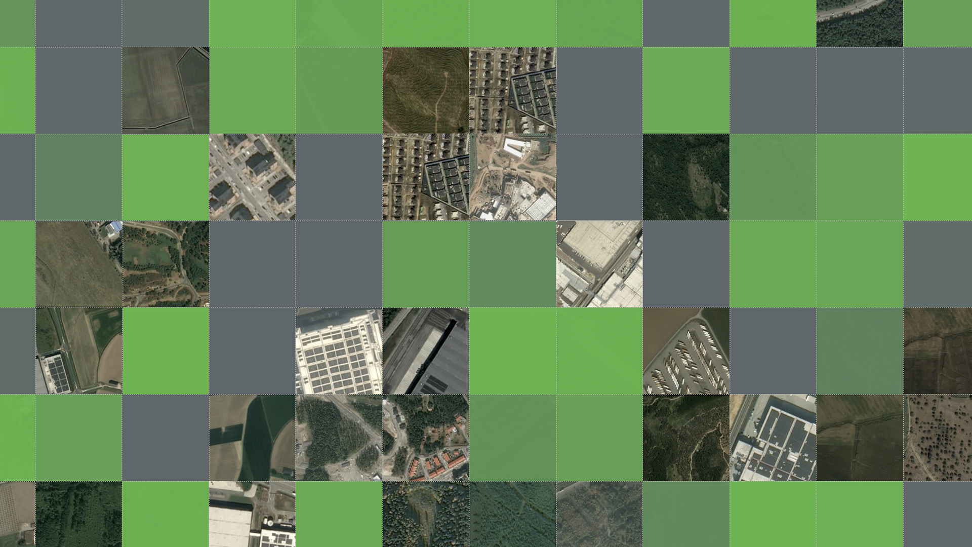
“We invite citizen scientists to log into the app and interpret satellite image time series — to verify whether there was nature loss or not.”
Watch how to use the Nature loss detector app
- Each participant is assigned specific locations, which helps make the data more reliable.
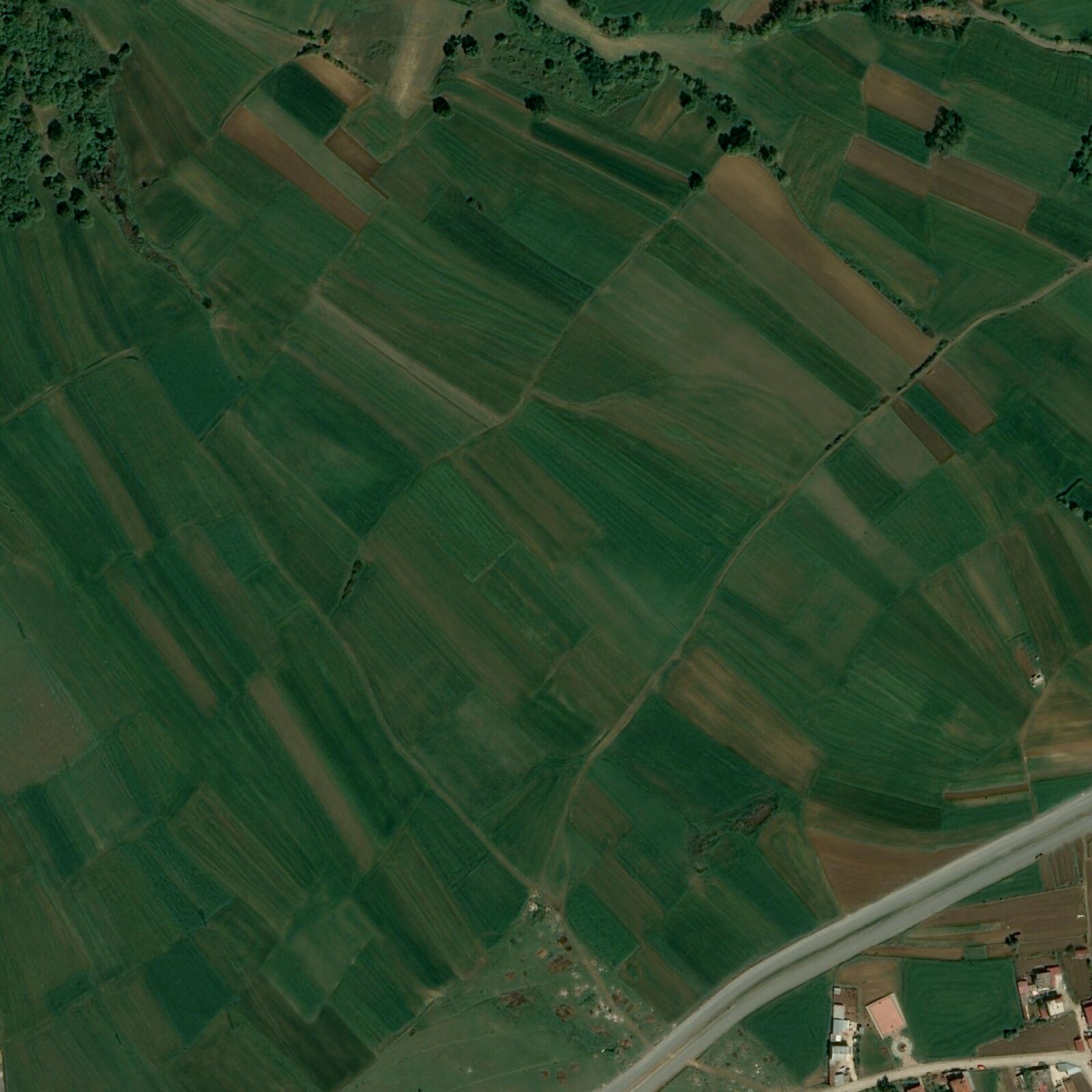
- You will see real satellite images of a location at different points in time. By comparing them, you have to decide whether the habitat has been lost or not.
- Only a small number of locations will show real cases of nature loss. Your task is to identify these true positives.
- Each location is reviewed by at least three contributors. Disagreements are checked by experts.
“If there’s disagreement, our team revisits those points. And there’s also an ‘uncertain’ option that we quality-check as scientists,” he adds.
The crowdsourced data will feed into a scientific paper quantifying global nature loss and help train machine-learning models capable of predicting future destruction.
“We hope to develop a model that can predict nature’s loss one or two years into the future based on early signs,” Venter says.
For him, the app is not only about data.
“It’s also a form of communication of science. People can see what nature loss looks like in satellite images and feel they’re contributing to addressing the global biodiversity crisis.”
The investigation “Green to Gray” was co-funded by Journalismfund Europe and IJ4EU